
Halloween The Game Maps
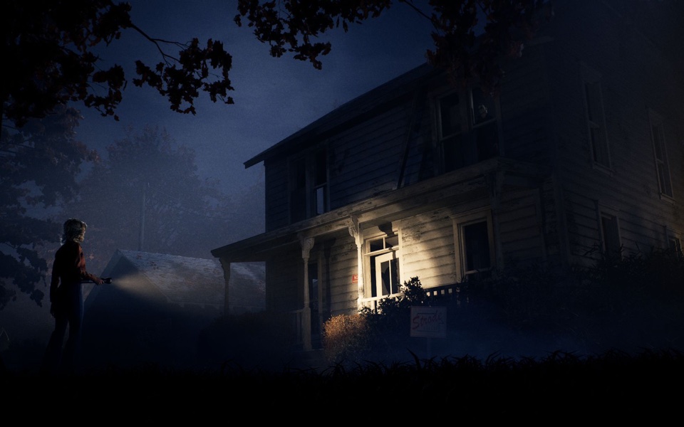
Halloween: The Game launches with four multiplayer maps set in and around 1970s Haddonfield. Verified (official): the maps are Haddonfield Heights, Orange Grove Estates, Haddonfield Town Center and East Haddonfield. The developer built them from 1978 film locations — the Myers house, the Strode residence, Nichols Hardware and more — and expanded them into full neighbourhoods for the 1v4 hunt.
Quick AnswerHalloween: The Game launched with four multiplayer maps: Haddonfield Heights, Orange Grove Estates, Haddonfield Town Center and East Haddonfield. Escape locations, key items and lootable containers change between matches, so map knowledge is about landmarks and sightlines rather than fixed spawn points.
Map Overview
Verified (official): IllFonic designed four unique multiplayer maps that mix iconic film landmarks with original Haddonfield locales. The locations were built from the 1978 film's set pieces — including the Myers' House, Nichols Hardware and the Strode residence — as starting points, with a full town constructed around them.
| Map | Character | Verified Landmarks | Verification |
|---|---|---|---|
| Haddonfield Heights | Family-friendly suburb | Strode house, the abandoned Myers' house on Lampkin Lane, a large water tower | Verified (official) |
| Orange Grove Estates | Upscale suburb | Doyle and Wallace residences, multi-story homes with garages and balconies, neighbourhood playground | Verified (official) |
| Haddonfield Town Center | Downtown commercial hub | Nichols Hardware, A-Side Music Store, Hill Garden Center, Patty's Pub | Verified (official) |
| East Haddonfield | Rural industrial outskirts | Rabbit in Red Lounge, Phelps Garage, Midwest Feed Company grain mill, silos and storage areas | Verified (official) |
Individual map guides: Haddonfield Heights · Orange Grove Estates · Haddonfield Town Center · East Haddonfield
Fixed landmark index: Myers House, film landmarks and map locations. For dynamic objectives, phones and residents, use the objectives guide; for key items and containers, see items.
Haddonfield Heights
Verified (official): Haddonfield Heights is the neighbourhood where the 1963 tragedy echoed for 15 years before the nightmare returned. This family-friendly residential area contains the iconic Strode house, and down the block towards Lampkin Lane sits the abandoned, allegedly haunted Myers' house. Numerous modest single-family homes and an enormous water tower complete the quiet streets.
Orange Grove Estates
Verified (official): Orange Grove Estates is Haddonfield's upscale suburb — a "forever home" neighbourhood of multi-story houses with detached garages and balconies, gathered around a wholesome community playground. Fans of the original film can explore the iconic Doyle and Wallace residences here.
Haddonfield Town Center
Verified (official): Haddonfield Town Center is the bustling cultural and economic heart of the town. Nichols Hardware sits at the centre of the district — the store where Michael completes his transformation into the Boogeyman. Nearby anchor businesses include A-Side Music Store and Hill Garden Center, while Patty's Pub offers a gathering spot for locals.
East Haddonfield
Verified (official): East Haddonfield is the rural agricultural hub on the outskirts of town, entered by Michael after his escape from Smith's Grove Sanitarium. It is home to the neon-soaked Rabbit in Red Lounge biker bar, Phelps Garage, and the Midwest Feed Company grain mill that anchors the district. The map's industrial core — mill, silos and storage areas — is flanked by farmland, highways and train tracks, with wrap-around porches, farm equipment and dirt parking lots scattered between buildings. The area attracts unsavory characters such as the Castle Hill Rooks biker gang.
Gameplay-wise, official material describes East Haddonfield as a more chaotic, open playspace than the city maps: haphazard sightlines, uneven fence configurations and clustered buildings that reward stealth. The openness can create enticing exit routes, but taking them risks exposing you to Michael.
Objective Locations
Verified (official): matches place points of interest, lootable containers, telephones and possible escape routes across the map — and the location of these changes from match to match. Because of that randomness, this guide does not publish fixed spawn maps or "best hiding spots": any specific spawn claim would need stable, gameplay-verified data first and remains Needs verification until then.
Item Spawn Information
Verified (official): lootable containers hold weapons, distractions and key items, and container positions vary between matches. Exact container spots, rarity tiers and per-map loot tables are not officially detailed; treat any third-party spawn list as Needs verification.
Police & Communication Locations
Verified (official): telephones appear across the map and residents can be urged to call the police. The overall police loop — growing evidence, community resistance and Michael being detained back to Smith's Grove — is confirmed. Exact phone spawn locations are not published and should be treated as Needs verification.
Michael Strategy by Area
These are general principles built on verified mechanics, not per-spot tactics:
- Suburban maps (Heights, Orange Grove, Town Center): dense houses create cover and sightline breaks. Use Shape Jump between lit areas and pressure residents indoors, where Heroes persuade NPCs and start escape work. Verified (official): Michael can affect lights and power to create darkness.
- East Haddonfield: the open, chaotic map gives longer sightlines for chases but also more cover for repositioning. Verified (official): its openness creates tempting exit routes — an escape attempt here is loud, so treat the map's edges as ambush ground.
Hero Strategy by Area
- Learn the landmarks, not spawns: because containers and routes randomize, orientation around fixed landmarks (the water tower, the mill, Nichols Hardware) is the reliable knowledge.
- Use indoor density: on suburban maps, houses give you places to hide and residents to persuade, but also trap you if Michael controls the exits.
- Respect open ground: on East Haddonfield, crossing open lots and farmland without a destination is how Heroes get caught. Move between buildings and check sightlines.
Map Navigation Tips
- Identify your escape type early. Locked gates, shelters and vehicles need different preparation, and escape locations are randomized (see the escape routes guide).
- Keep track of lights. Verified (official): darkness protects Michael's movement, and he can shut off lights or cut power — when an area goes dark, assume he can move through it.
- Use phones deliberately. Calling the police escalates pressure on Michael, but it also draws attention to your position.
- Move with residents. Persuaded NPCs travel with you, so route planning matters for the whole group, not just yourself.
How Map Rotation Works
Official Patch 1.0.1: public matches no longer repeat a map until cycling through every available map. This is a rotation rule, not a promise about which map appears next or a fixed selection order.
Links to Escape Routes
See the dedicated Halloween: The Game escape routes guide for how escapes work, what they need and when to attempt one. For the items that unlock or support escapes, see the items guide.
FAQ
How many maps does Halloween: The Game have at launch?
Four multiplayer maps: Haddonfield Heights, Orange Grove Estates, Haddonfield Town Center and East Haddonfield. Verified (official).
Which map has the Myers house?
The abandoned, allegedly haunted Myers' house is on Lampkin Lane in Haddonfield Heights, near the Strode house. Verified (official).
Is there a map based on the movie's famous street?
The maps recreate several film landmarks — Myers' house, Strode residence, Nichols Hardware, Doyle and Wallace residences — inside full neighbourhood layouts, rather than copying a single movie street. Verified (official).
Are item spawns the same every match?
No. Verified (official): the location of lootable containers, key items and possible escape routes changes from match to match.
Last Updated: September 12, 2026 · Current Patch: 1.0.1